
Salmon Glacier, Hyder Alaska
Our Icefields Are Melting, Our Memory As Well

Salmon Glacier - Photo courtesy of stewarttourism.comI ducked back into the U. S. from Stewart, British Columbia to Hyder, Alaska (population 48) on January 2, 2024. Hyder is located at the most southeastern point of the Alaska Panhandle and so is the closest town in Alaska to the continental U. S.
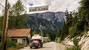
Downtown Hyder, Alaska Photo courtesy of calledtowander.com
As such, it is useful to those people — and they do exist — that want to be able to say that they have visited Alaska without having to go to the considerable trouble involved in actually doing the deed. Which reminds me of a time that, after supper, I travelled into the sunset from Kingman, Arizona, to cross the California line and then I turned around and drove right back. I counted California then as one of the States that I had visited. That doesn’t really count (unless you count it.)1
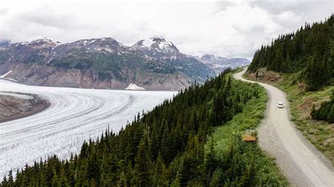
We were there for a reason because there is no road to anywhere else except back the way you came. There is not much at Hyder but you can see everywhere the evidence that Alaska’s economy is based on the extraction of natural resources—the small boat harbor (which doubles as a landing strip for float planes), is afloat with thousands of logs on their way to a sawmill, and the roads (sometimes closed for blasting and other mining activities) are gouged and crushed by the weight of the huge ore trucks and their payloads on the way to the gold smelters. And there is the Salmon Glacier.
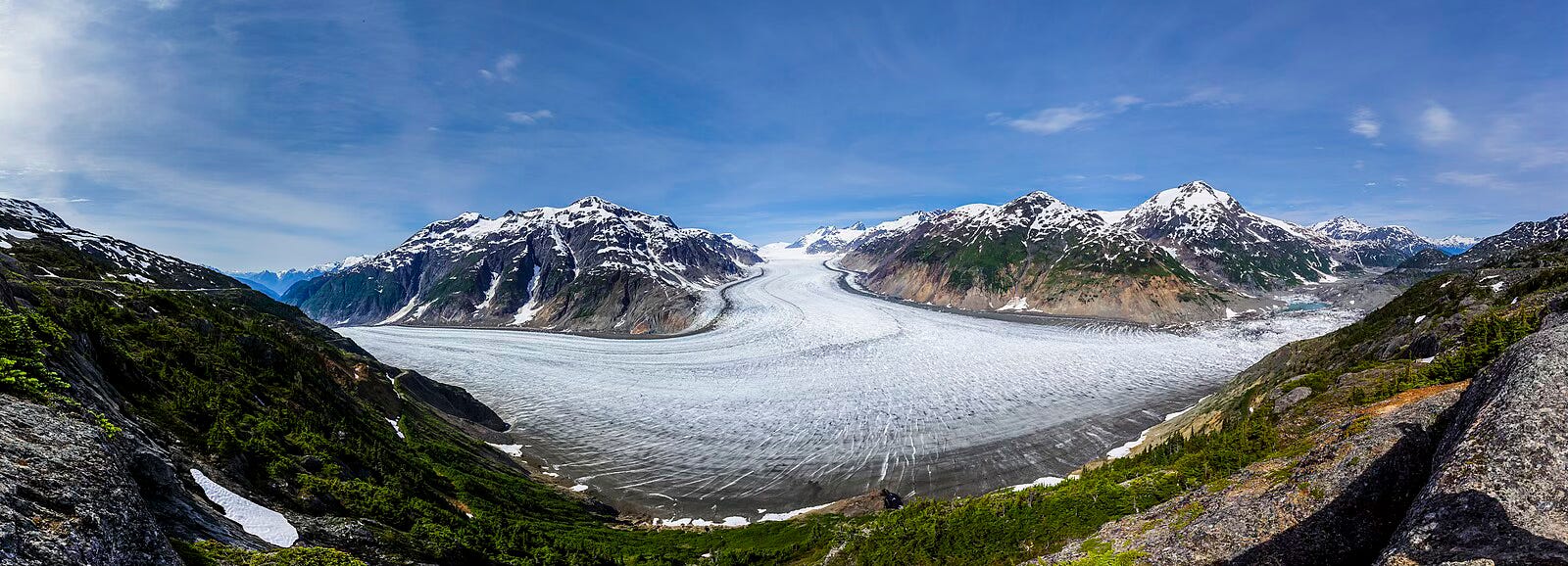
Panoramic View of Salmon Glacier - Photo courtesy of WikipediaThe next day we drove out into the mountains on the Granduc Road along the Salmon River. It eventually became a gravel road and then became part of an open excavation gold mine and just as the road became blocked by snow drifts we could see the Salmon Glacier ahead. It is the fifth largest glacier in North America but is in a very remote location and so not a huge tourist attraction. I have not been able to find any documentation of how much the glacier has receded in the last 100 years.
On June 4, we drove back the way we came and took the Cassiar Highway north through British Columbia to Dease Lake, Yukon, and the Alaska Highway. Then west to Alaska at Skagway.
Fact check while writing: I consulted a map to see how many miles it is west from Kingman to the California line. Nevada is west from Kingman. California is southwest on a State Highway to Needles, and the California line is the Colorado River, which I know I did not cross. So, . . . there you go — the unreliability, yes even outright lies, of memory. Not only does it not count to just cross the line and go back, but I didn’t even cross the line. I suspect that what really happened was that — driving into the sunset — my dear companion convinced me that we were on a fool’s errand, and guess what . . . memory being so accommodating . . . I now remember making a U-turn in the middle of nowhere (at sunset of course) and returning to Kingman. So . . . there you go. And I still have a visit to California to look forward to.
Thanks, Tom, for sharing! I hope you are doing well. please take care! Eston